
Riding to the Kingdom of Lo
Kathmandu to Lo Manthang by Royal Enfield
Upper Mustang was closed to foreigners until 1992. Reaching its walled capital by motorcycle means following a river gorge, crossing a 13,681-foot (4,170-meter) pass on loose rock, and arriving in a town that has kept its shape since 1380.
Beyond the Roads, Into the Kingdom of Lo
High in the Himalayas, beyond the busy streets of Kathmandu and the winding roads of Nepal’s mountain valleys, lies Upper Mustang, a remote region where ancient monasteries, centuries-old villages, and Tibetan traditions remain part of everyday life. Getting there on a motorcycle means following the Kali Gandaki River through narrow gorges, climbing rocky mountain passes, and riding into a landscape shaped by wind, altitude, and generations of people who have called these mountains home.
For Prabhash Thakur, founder of Nepal Moto Tours, these roads are familiar territory, yet every journey brings another reason to return. Riding a Royal Enfield Himalayan 450, he takes us from Kathmandu to the walled city of Lo Manthang, sharing the challenges of the route and the quiet moments that stay with a traveler long after the engine stops. Along the way, we discover a corner of Nepal where the journey unfolds through the people, places, and traditions encountered on the road.
Fill the Tank at Beni
Everything I tell riders about the Upper Mustang starts at Beni. Fill the tank here, because the tarmac ends, the Kali Gandaki gorge takes over, and the next dependable fuel is in Jomsom.
I trained as an engineer before I became a guide, and I started Nepal Moto Tours in 2022 to show riders the parts of the Himalayas I love. Of all our routes, this is the one I would choose if I could ride only one. In April 2026, I rode it again: ten days, about 684 miles (1,100 kilometers), from Kathmandu to Lo Manthang and back, on Royal Enfield Himalayan 450s with a support vehicle behind us.
I chose it for this story because it shows what motorcycle travel in Nepal really is. It starts on an easy highway, then turns into a rocky track along a river gorge, then into a high desert, and ends in a medieval town with a living royal family. Few places in Asia change this much in ten days.
The Route: From the Highway to the High Desert
The Warm-Up: Kathmandu to Pokhara
The first day is 124 miles (200 kilometers) on the Prithvi Highway to Pokhara, and it is the only easy day of the trip. We leave Kathmandu early to get past Naubise before the trucks fill the road. The highway follows the Trisuli River through terraced hills, and we stop at Mugling for dal bhat, which I consider compulsory. Pokhara by early afternoon, then a proper rest. I tell the group the same thing every time: sleep well tonight, because the riding gets serious tomorrow and stays that way for several days.
The Kali Gandaki Gorge: Beni to Tatopani
Pokhara to Beni is comfortable tarmac through the Modi Khola foothills. At Beni the pavement ends and the Kali Gandaki gorge begins.
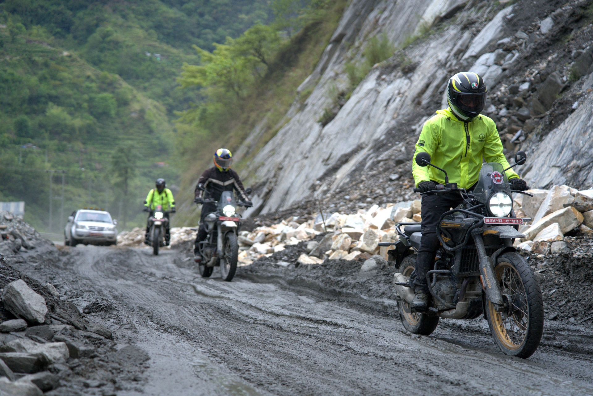
Over the next 28 miles (45 kilometers) to Tatopani, the road becomes a rocky shelf cut into the gorge wall, high above the river. Waterfalls cross the track and you ride straight through them. Between Ghasa and Tatopani the walls close to near vertical and the road narrows. It is slow, tiring and thrilling, and it is where most riders first feel how big this landscape is.
We reach Tatopani in the late afternoon. It is named for its hot springs, and after a day like that the sulfur pools feel like a reward. We soak and watch the gorge go dark. The guesthouse food is simple, and after that day nobody complains.
Apples, Wind, and the Gateway at Kagbeni
The next morning the road climbs from Tatopani’s 3,937 feet (1,200 meters) through Ghasa, past the Rupse waterfall near Lete, and through Kalopani, where Dhaulagiri and Nilgiri fill the sky. The valley grows steadily drier as we climb.
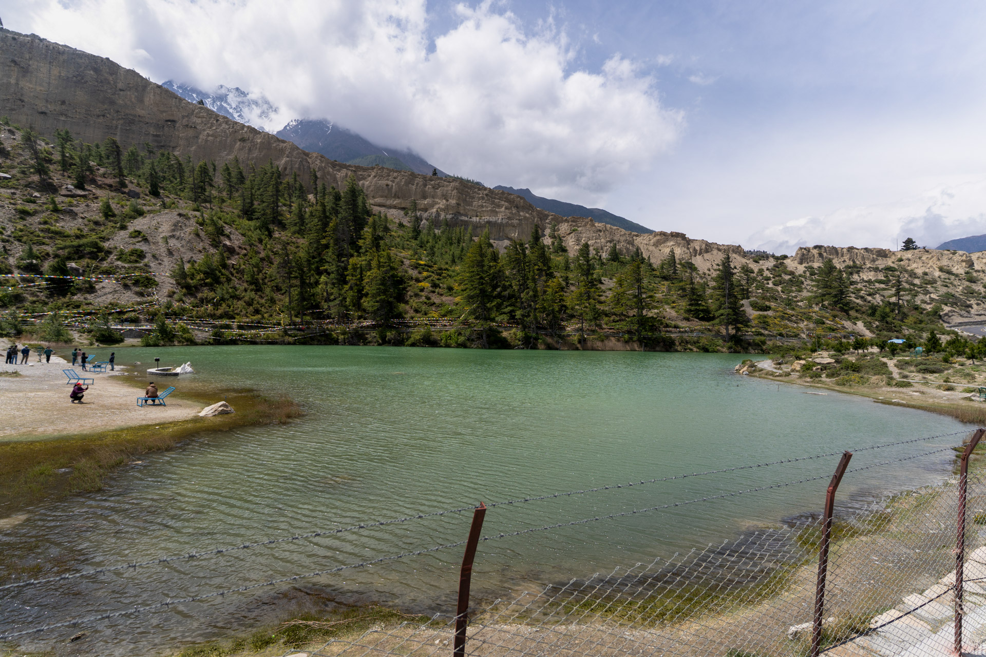
Marpha is a mandatory stop. It is the apple-growing village of Nepal, with white stone alleys, a small monastery on the hill above, and bakeries selling apple pie that I will argue is the best in the country. In early April the orchards are in blossom and every tree is white. I give the group at least forty minutes here.
Jomsom is 4.3 miles (7 kilometers) further. This is the last reliable fuel and the last cash machine before Lo Manthang, so we fill every tank and withdraw every rupee we will need.
Then comes Kagbeni, 7.5 miles (12 kilometers) north. An ochre monastery stands on a bluff above flagstone alleys, and the Kali Gandaki runs fast and cold below. North of the village is the checkpoint where the restricted area begins. We walk the village in the afternoon and look north, where the valley narrows and the Tibetan plateau begins to show. Tomorrow we ride into it.
A word on the wind, because it shapes the whole trip. From about 11 a.m., a wind builds up the Kali Gandaki valley and can reach 25 mph (40 km/h) above Jomsom. It is tiring and it makes riding hard. So we set one rule that I never bend: every riding day above Jomsom starts before 8 a.m., and we aim to reach our destination before the wind does.
Into the Restricted Area
Canyons, High Passes, and Ancient Villages
At Kagbeni we hand over our permits, which are checked here and again on the way out. Then we cross the river and ride north.
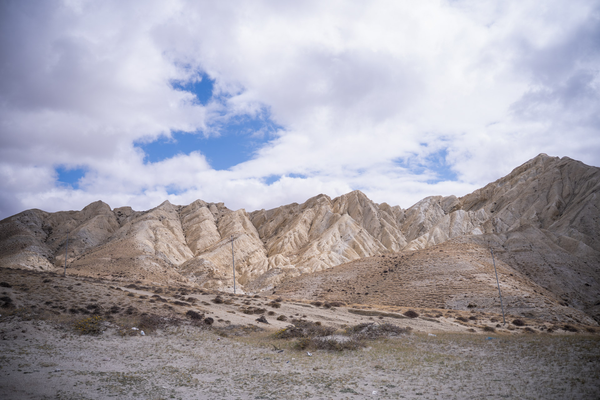
The first village is Tangbe, whitewashed stone with flat roofs. It tells you at once that the culture ahead is Tibetan. The track then climbs into a canyon system where the river has cut through the uplift and exposed layers of sediment in red, ochre, brown, gray and white. Each bend opens onto another canyon, and each descent reveals another village that looks as if nothing has changed since the 15th century.
The route crosses the Kali Gandaki several times, and the depth depends on the season. Spring snowmelt in April can raise it. The surface is rock and riverbed, and progress is slow. We climb over the Taklam La at 11,811 feet (3,600 meters) and the Dajori La at 11,975 feet (3,650 meters), with the Annapurna range building behind us. Descents are on loose rock, and the bikes need patient riding.
Between Chele and Samar, a short detour leads to Chungsi Cave, an old Buddhist meditation cave carved into the cliff above the valley. A monk sometimes looks after it. We go in quietly, as anyone should. Further on, Samar sits in a grove of old poplar trees, an unexpected patch of green in the high desert. We end the day in Ghami, a wide farming basin with barley fields and a long mani wall visible from the track above.
The Day We Arrive in Lo Manthang
Day five is the one the whole trip builds toward, and it is only about 34 miles (55 kilometers). We leave Ghami early and ride past the mani wall, the longest in Upper Mustang, a prayer wall of carved stones and flags that runs for hundreds of yards (hundreds of meters) across the valley. I ask riders to go slowly past it. The scale deserves that.
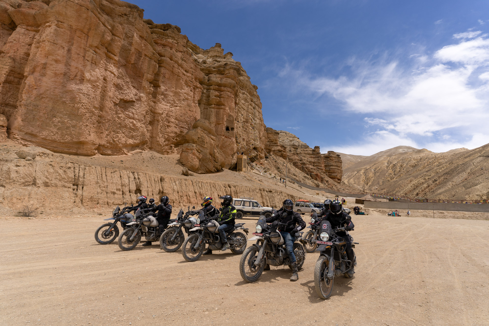
The track climbs toward Dhakmar, and above the village stand the red cliffs I always ask riders to stop and look at. They rise about 656 feet (200 meters), full of the openings of old sky caves. Locals say the red comes from the blood of a demon killed by Guru Rinpoche. Geologists say it is iron oxide in ancient sea sediment. Standing under the cliffs in morning light, I find the local story easier to believe.
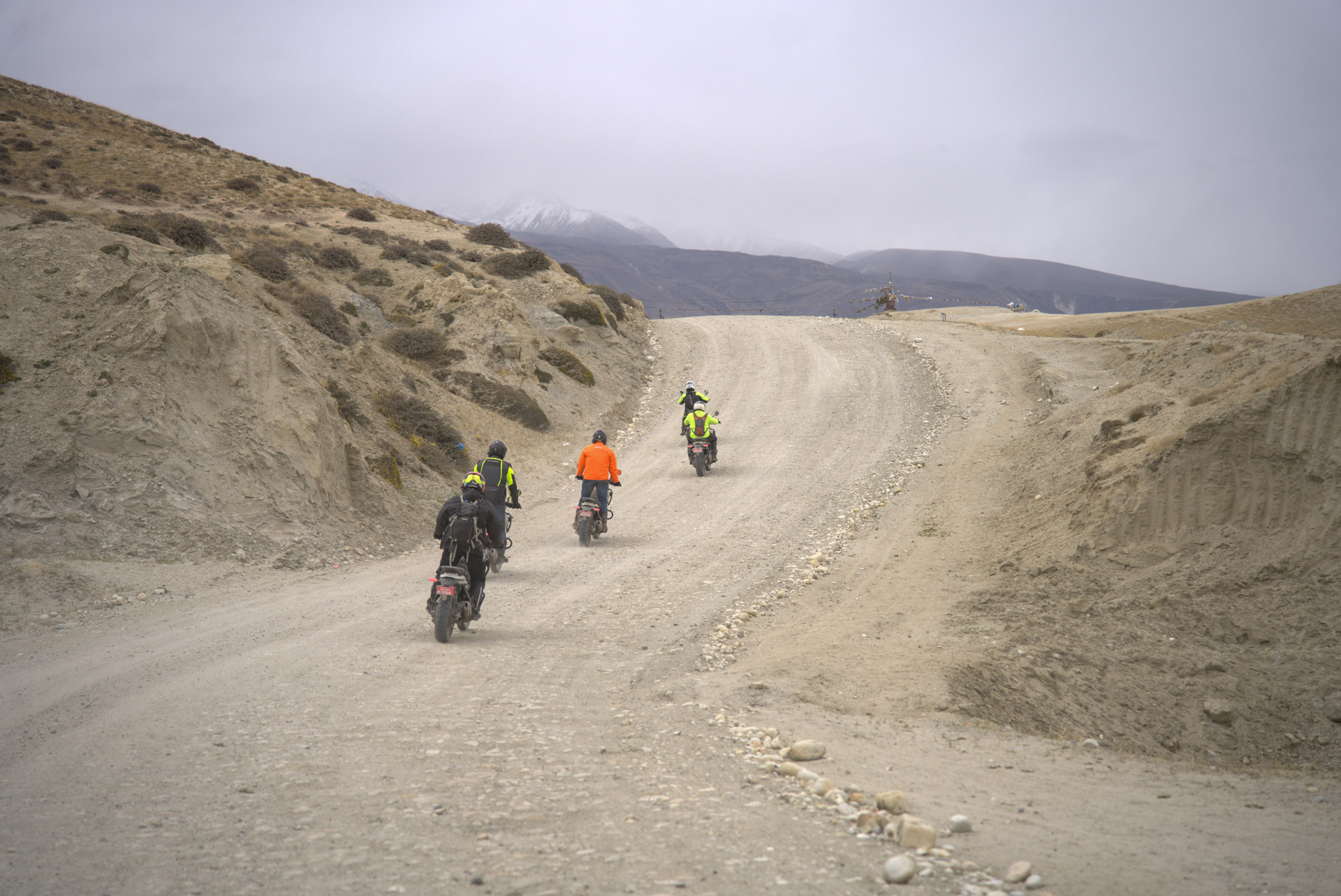
From Dhakmar the track climbs steeply to Mui La, at about 13,681 feet (4,170 meters), the highest point of the trip. The air is thin and the engines feel it. On my Himalayan the power was noticeably down, though it ran cleanly with no trouble. On a clear day the view is enormous: the plateau stretching north toward Tibet, the Annapurna and Dhaulagiri ranges behind, and ahead the first open sight of the valley below Lo Manthang.
A short detour from the pass leads to Ghar Gompa, also called Lo Gekar, which is the oldest Mahayana Buddhist monastery in Nepal and is said to have been founded by Guru Rinpoche in the 8th century. If time allows, stop. The age of the place is felt in the room.
We drop to Tsarang, the second town of Upper Mustang, with its old dzong and a monastery containing very fine murals. Then the track descends to the river and climbs again to Chogo La. And on the descent from that last pass, Lo Manthang appears: a rectangle of mud-colored walls on a flat plateau at 12,598 feet (3,840 meters), ringed by barley fields and prayer flags, with the Annapurna and Nilgiri ranges along the southern horizon.
We ride in through the eastern gate. The wall is 2,808 feet (856 meters) long, about 20 feet (6 meters) high and 3.3 feet (1 meter) thick, and King Ame Pal built it in 1380. Around 150 stone and mud-brick houses stand inside. The lanes open onto a small public square, and facing it is the Royal Palace, five stories of mud, stone and carved timber, home to the family of the Mustang king. I have arrived here many times and it still stops me. We check in at the Mandala Hotel, and the group usually says very little.
Two Days Inside the Walls
Monasteries, Murals, and Traditions
I plan two full days in Lo Manthang, and riders sometimes argue for skipping one. Nobody argues by the end.
Early morning is best. The light on the walls and the mountains is at its best before the town fully wakes, and the alleys are quiet. We visit Thubchen Gompa, the great red assembly hall from the late 15th century. Its walls are covered in murals about 500 years old, which an international conservation team has been restoring since the early 2000s, and the restoration has brought back color and detail that had been hidden for decades. If we arrive before the monks’ morning puja, we sit in the dim hall with butter lamps lighting the paintings and the chanting filling the room. It is the best moment of the whole route for many riders, and there is not a motorcycle in it.
On the second day we visit Jampa Lhakhang, the oldest monastery in town, with a huge standing Maitreya Buddha. We visit Chode Monastery, where the monks keep up daily rituals that continue medieval practice, and the Amchi Museum, which documents the traditional Tibetan medicine practiced here for centuries. We walk up to Namgyal Gompa above the walls for the best view down on the town. In April the fields outside the walls are being prepared for planting and yaks work the barley terraces. Prayer wheels turn, juniper incense burns, and the plateau is very quiet.
The Chhoser Cave Complex Excursion
For confident riders there is an optional afternoon ride of about 31 miles (50 kilometers) round trip to Chhoser, on the roughest track of the whole trip. It leads to ancient multistory cave complexes cut into the cliffs, used over more than a thousand years as meditation cells, burial places and grain stores. Nyphu and Garphu monasteries are nearby. The track is exposed and rocky, and riders have had punctures and small falls here. I tell people to be honest with themselves before deciding.
The Return Journey
We leave Lo Manthang in the morning before the wind. The same route feels different in the other direction. The light falls differently, the views reverse, and the riding is faster on ground we now know. We cross Mui La early while the air is still and cold, and pass Dhakmar with the cliffs catching the sun from another angle. Kagbeni by early afternoon, where the permits are checked once more.
That night we stay in Marpha, and the apple pie and local brandy taste better the second time. Then Tatopani for one more soak if time allows, Beni for fuel, tarmac again, and Pokhara by evening. The last day is the Prithvi Highway back to Kathmandu, with dal bhat at Mugling.
What You Need to Know Before You Go
Is It for You?
I rate this ride very challenging, and I say so plainly. The section between Kagbeni and Lo Manthang is demanding across several days: river crossings, loose rock, steep off-camber ground and narrow cliff-edge passages. You should be comfortable riding a heavy loaded bike, about 441 pounds (200 kilograms), on loose surfaces and moving water, and you should have real off-road experience. It is not a good first adventure ride. If you have that experience and reasonable fitness, it is achievable and rewarding.
Motorcycle Setup and Support
We ride the Royal Enfield Himalayan 450. It has the low-end torque for sustained climbing on rock, holds up on the highway days, and copes with ten days of rocks, dust and river crossings. Our bikes carry a bash plate, luggage rack and hand guards. On the April ride the bash plate took several serious rock strikes between Kagbeni and Lo Manthang, and the hand guards proved their worth in the gorge. The tank holds 4.5 US gallons (17 liters) and the bike gets about 67 to 78 mpg (3 to 3.5 liters per 100 kilometers) off-road.
Beyond Kagbeni, the nearest workshop that can do serious repairs is in Jomsom. We travel with a support vehicle carrying spare parts, tools and extra fuel. I strongly recommend this for anyone attempting the route. If you go without one, carry a full toolkit, tire repair kit, spare levers, cable ties, duct tape and spare fuel.
Clothing and Equipment
- Sealed goggles and a buff. The dust above Kagbeni is fine and constant, and by day seven it is in everything.
- A windproof shell over your riding gear for the afternoon windows.
- Layers for cold nights. In Lo Manthang, daytime is around 50 to 64°F (10 to 18°C) and nights drop to between 21 and 28°F (-6 to -2°C).
- Offline maps downloaded before you leave Kathmandu. Mobile signal is patchy above Jomsom.
- A satellite communicator, since there is little or no signal above Kagbeni for about five days.
- A full first-aid kit, your own medication and any altitude medication recommended for you by a qualified medical professional.
Altitude Considerations
Lo Manthang sits at 12,598 feet (3,840 meters) and Mui La at about 13,681 feet (4,170 meters). The Chhoser excursion goes higher, up to about 15,289 feet (4,660 meters). Altitude sickness can develop quickly at these heights. We break the climb at Jomsom or Kagbeni before pushing north, and I would never ride from Pokhara to Lo Manthang in two days. Riders should know the warning signs, including headache, nausea and loss of coordination, and descend if symptoms worsen. Before traveling at altitude, get appropriate medical advice and make sure your travel insurance provides suitable emergency and evacuation cover for the route.
Best Seasons and Weather
Upper Mustang sits in the rain shadow of the Annapurna and Dhaulagiri ranges and gets very little rain in spring. April and May are my favorite months: clear skies, mild days, sharp mountain views, blossoms in Marpha and Kagbeni, and the Tiji Festival in Lo Manthang, usually in late April or May. Book accommodation weeks ahead if you plan to be there for Tiji. We also run the route in autumn, and our next departure is in October 2026.
Elsewhere in the year the picture changes. The lower Kali Gandaki gorge between Beni and Tatopani is where monsoon landslides cause trouble, and in winter the cold and snow on the high passes make the ride far harder and many guesthouses close. Whatever the season, the afternoon wind stays the same.
Permits and Regulations
Upper Mustang is a restricted area, so international visitors need to arrange the required paperwork before entering the restricted zone.
- At the time of writing, Nepal’s Department of Immigration lists the Upper Mustang Restricted Area Permit at USD 50 per person per day.
- An Annapurna Conservation Area entry permit is also required for the route.
- Permit rules and supporting travel documentation can change, so riders should confirm the current requirements with Nepal’s Department of Immigration, Nepal Tourism Board and a registered Nepali agency before departure.
- Restricted-area travel must be arranged in accordance with the current government rules through an authorized Nepali agency.
- Arrange the paperwork well before the planned departure rather than leaving it until arrival.
- Permit documents are checked at control points on the route, including around Kagbeni, so keep the required originals or official documents accessible while traveling.
Fuel, Cash, and Logistics
Beni has the last reliable fuel before the mountains. Tatopani sometimes has some but should not be relied on. Jomsom has the last fuel and last cash machine before Lo Manthang. From Jomsom to Lo Manthang and back is about 81 miles (130 kilometers), which a full tank covers with a reserve. If you add the Chhoser excursion, plan from the fuel you have in Lo Manthang. I carry 0.8 US gallons (3 liters) of spare fuel. Above Kagbeni everything is paid in cash. I budget NPR 10,000 to 15,000 per person per day for lodging, meals and contingencies in the restricted zone.
Where to Stay and Eat
We stayed at Hotel City Inn in Pokhara, a guesthouse in Tatopani, Hotel Jomsom Pride in Jomsom, a local guesthouse in Ghami, the Mandala Hotel in Lo Manthang and Marpha Palace on the return. The Mandala has the best kitchen and the best terrace view over the walled city, and the Snow Leopard Guest House is a solid alternative. Above Kagbeni, rooms are basic by city standards and comfortable by the standards of the region.
The food is what you find on a high trade route: dal bhat, thukpa, momos, tsampa, yak cheese, dried meat, buckwheat. In Kagbeni I always recommend the butter tea, made from brick tea, yak butter and salt. Most people need a few cups before they enjoy it, and by Lo Manthang most of my riders are asking for it themselves. In Marpha, go for the apple pie, cider and brandy.
Riding Responsibly in a Remote Place
This is a living Buddhist culture and the villages are small, so behavior matters.
- Ask permission before photographing inside monasteries.
- Take off your riding boots before entering any religious site.
- Leave a small donation at each gompa you enter, and never go into inner sanctums without an invitation.
- Ride slowly through villages and past mani walls.
- Respect the permit system. The guide requirement and daily permit fee keep numbers low, and I think that is part of why the culture has held together. We keep groups to four to ten riders.
- Travel with a support vehicle so a breakdown never becomes a burden on a village.
- Spend locally. Eat and sleep in local guesthouses and buy Marpha’s produce. Above Kagbeni, that money goes directly to the communities you ride through.
Was It Worth It?
Ask me and I will say yes without hesitating. The dust gets into everything, the wind tests your patience and balance, and the altitude reminds you who is in charge. Then you come down from Chogo La, see the walls of Lo Manthang below, and ride in through the eastern gate with centuries of history around you. That moment is why I keep returning to this route. Some places justify everything it takes to reach them. For me, Upper Mustang is one of them.
Route Facts
- Route: Kathmandu, Pokhara, Tatopani, Jomsom, Kagbeni, Ghami, Lo Manthang, and back via Marpha
- Duration: 10 days, 9 nights, including two nights in Lo Manthang
- Distance: about 684 miles (1,100 kilometers), with 5 to 7 hours of riding on riding days
- Highest points: Mui La at about 13,681 feet (4,170 meters), Lo Manthang at 12,598 feet (3,840 meters)
- Difficulty: very challenging, off-road experience essential
- Motorcycle: Royal Enfield Himalayan 450
- Best seasons: April and May, and autumn
- Permits: Restricted Area Permit and applicable conservation-area/travel documentation; confirm current requirements before departure
- Local perspective: Prabhash Thakur, Founder, Nepal Moto Tours
About the Author | With Thanks from BTA
Prabhash Thakur is a Nepal-based motorcycle guide and the founder of Nepal Moto Tours, headquartered in Bhaktapur. Since 2022, he has been guiding riders through the Himalayan landscapes of Upper and Lower Mustang, Manang, and the Kathmandu Valley, sharing the roads, communities, and traditions he has come to know through years of riding.
Bike Travel Adventures Magazine extends its sincere thanks to Prabhash for sharing his journey through Upper Mustang with our readers. His firsthand knowledge of these remote routes and his connection to the people and culture of Nepal bring a valuable local perspective to this story.
To learn more about Prabhash and his motorcycle adventures in Nepal, visit Nepal Moto Tours or follow @nepalmototours on Instagram.
Words by: Prabhash Thakur – Photo Credits: Prabhash Thakur
Articles in this issue
The Adventure of Sea To Sky 2026
Three days, one mountain, and a Turkish coastline that has drawn travelers for thousands of years. From Shoreline to Summit: The Challenge of Mount Tahtalı From the beach at Kemer, on Turkey’s...
The Rally Idea Comes Home with the 2027 KTM 690 Rally
The Rally Idea Comes Home with the 2027 KTM 690 RallySome motorcycles arrive with a clear purpose. The 2027 KTM 690 Rally is one of them. Built on the current 690 Enduro R platform, KTM’s new Rally...
2026 Honda XL750 Transalp E-Clutch
2026 Honda XL750 Transalp E-Clutch Built Around the JourneyThe real test of an adventure bike often comes after the scenic overlook: a loaded climb, a slow crawl through traffic, a rough stretch of...